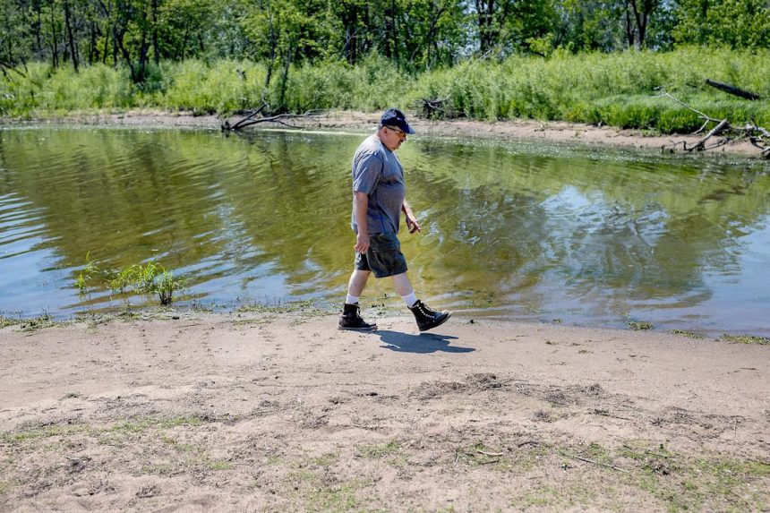
Lake Pepin, the largest naturally occurring lake on the Mississippi River, is a beloved resource and important economic engine for the Wisconsin and Minnesota towns that border it.
In the summer, its calm, expansive waters are popular for sailing and waterskiing — the latter of which was invented on the lake in 1922. In the winter, it’s an ice fishing hub.
But it’s got a big problem: massive amounts of sediment are eroding from streambanks, bluffs and agricultural fields upstream and settling in the lake. Parts of it have become so shallow that boat travel is impossible, leaving some communities cut off. The upper one-third of the lake could be unusable for recreation by the end of this century.
A new yearlong project aims to understand how to curb an overlooked source of that sediment.
The Lake Pepin Legacy Alliance, a nonprofit organization working to improve the health of the lake, has launched an investigation into how erosion can be controlled in ravines and gullies. Ravines act like fast-moving highways, delivering soil either into the Mississippi River and then the lake, or directly into the lake itself, according to the alliance. The analysis will be led by Norman Senjem, who retired from the Minnesota Pollution Control Agency in 2011 and has deep knowledge of the lake’s challenges with sedimentation.
Senjem plans to work with county conservationists and watershed groups in south central Minnesota, which delivers large sediment loads to Lake Pepin, to identify the best ways to stop erosion from ravines.
Michael Anderson, executive director of the Lake Pepin Legacy Alliance, said with results from Senjem in hand, landowners will be able to take action to stop sediment from ravines on their properties.
“We’re obviously not the people who will be the excavators,” he said. “We’ll help put the pieces together and start to push the snowball down the hill to get momentum going.”
‘Hidden’ ravines deliver huge sediment loads to Lake Pepin
Lake Pepin, which stretches 21 miles between Bay City and Nelson on Wisconsin’s western border, has always acted as a sort of settling pond for sediment. Once river water enters the top of the lake, its slower-moving waters allow silts and other particles to drop to the bottom, and the water that exits the lake and flows further down the river is cleaner.
But sediment erosion has increased tenfold since before European settlement of the area. Each year, a sediment load as big as a 32-story building spanning a full city block enters the lake, according to the Lake Pepin Legacy Alliance. At this rate, the entire lake could be filled in less than 350 years.
A large majority of that sediment comes from the Minnesota River basin, which covers nearly 15,000 square miles, including many areas that are heavily farmed. There are thousands of ravines that cut through the slopes on the sides of the river, ushering sediment from the farmed landscape quickly downstream.
“But they’re kind of hidden away,” on the edges of farm fields or wooded areas, Senjem said. “I’m going to try to shed some light on them.”
Built structures called water and sediment control basins can intercept sediment from ravines, he said. But increased rainfall across the Midwest due to climate change is rendering the basins less effective. The expanded use of agricultural drainage tile in the Minnesota River basin, an underground pipe network meant to more easily drain farm fields, also contributes to water flowing faster down ravines.
Senjem expects to find that more work will be necessary to control the problem, such as building multiple control basins in a row to slow the sediment or adding so-called “buffer strips,” made of grass or permanent vegetation, to help catch more of it.
More: Cuts to agencies that study, safeguard Mississippi River have to stop, advocates say
Over the next year, Senjem will study which options like these have been implemented across south-central Minnesota to limit sediment from ravines. Those might offer a road map to members of the Legacy Alliance as to which types are most effective. Since such projects can be costly, he’ll also include in his analysis what kinds of financial assistance is available to landowners to undertake them.
For landowners to want to take action to save a lake many miles away, there’s got to be local incentive, too, Senjem said — like if a restored ravine would protect a road or smooth out a farm field. He’ll prioritize potential solutions that do that as well.
The project is funded by a $15,000 grant from the Red Wing Area Fund, a community foundation on the north end of Lake Pepin.
Madeline Heim covers health and the environment for the Milwaukee Journal Sentinel. Contact her at 920-996-7266 or mheim@gannett.com.
This article originally appeared on Milwaukee Journal Sentinel: As Mississippi River’s Lake Pepin shrinks, landowners look for options


