Cue “It’s the most wonderful time of the year!” — but no, we aren’t talking about Christmas just yet.
Floridians are talking about the dry season, a well-deserved gift after several months of stifling heat and humidity.
After living in the Sunshine State for almost three years, I think this really is the best time of the year and many snowbirds would agree. We can breathe a little easier now, literally, knowing the hottest and most humid part of the year is behind us. And we worry a little less knowing hurricane season is almost over.
Dry Season
Florida’s dry season usually arrives by the middle of October, lasting through the middle of May.
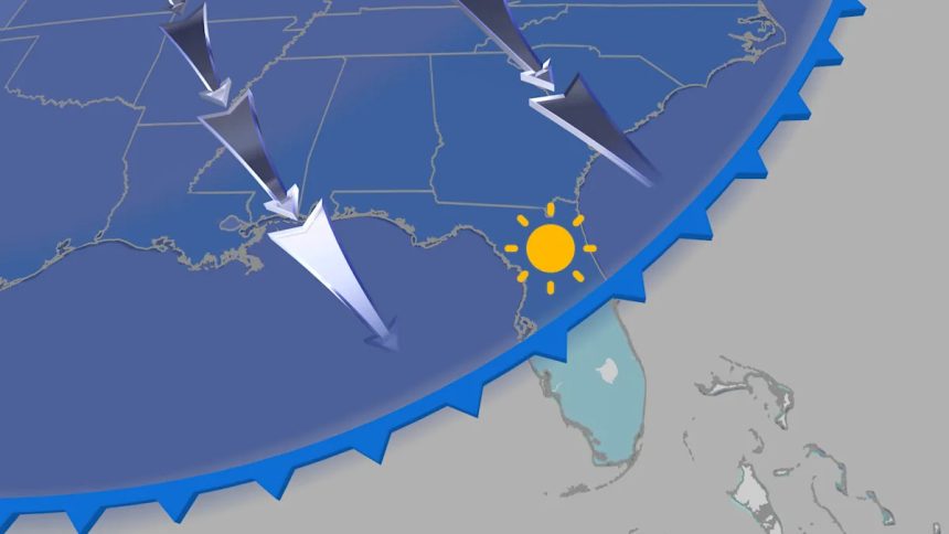
Florida wet dry seasons
During this time, the jet stream is stronger, which allows cold fronts to sweep across the state. Rain associated with these fronts is usually in the form of thin bands that push through quickly. And with limited moisture, rainfall is typically on the light side. The cooler and less humid air behind the front stabilizes the atmosphere, leading to extended stretches of dry and comfortable weather. This pattern is very different from the daily threat for showers and thunderstorms seen during the summer months.
With hurricane season officially ending Nov. 30, any threat for tropical downpours will come to an end as well.

While arctic cold air masses can and do briefly sweep into Florida each winter, they usually only last a few shivering days before it warms back up again. Just make sure to pack a jacket for any chilly mornings or breezy days behind a cold front, if you visit in what’s considered “winter” in the rest of the U.S.
Rainy Season
Florida’s rainy season usually runs from the middle of May through the middle of October. This is when many cities pick up most of their yearly rainfall.

Florida wet dry seasons
From late spring through early fall, cold fronts no longer penetrate that far south, so warmth and humidity simply build. Thunderstorms often erupt along small-scale sea breeze boundaries each afternoon. At times, these thunderstorms can almost seem like a daily occurrence. With the lack of steering currents in the mid-levels of the atmosphere, storms are often slow-movers and efficient rainfall producers, capable of dumping several inches of rain in a short period of time.
Keep this in mind if you’re planning a summer trip. Afternoon thunderstorms in the summer are the norm. Think of it as the state’s natural air-conditioning without a dehumidifier.
Then, there’s hurricane season, another contributor in this wetter season. And remember: You don’t need a strong hurricane to dump excessive amounts of rain across the state.
Looking Ahead To Winter
According to NOAA’s Climate Prediction Center, a weak La Niña has developed and is expected to persist through the winter months. What does this mean for the Sunshine State?
A potentially warmer and even drier dry season. There’s reason to believe this November through April could be even drier than usual. While it’s only one factor influencing the weather pattern, a look back at the last 14 weak La Niña dry seasons since 1950 indicates a rather strong signal for an even drier than usual dry season ahead in Florida.

This is not welcome news, as many cities in Florida are running well below average when it comes to rainfall for the year. This may be surprising as September into October has been rather wet for much of the East Coast of Florida. Unfortunately, a warm and dry winter could allow brush fires to become more common.

Tiffany Savona is a digital meteorologist for weather.com. She has 15+ years of experience tracking storms as a broadcast meteorologist across the country.