Freeze warnings are in effect across much of Wisconsin and the Great Lakes region this week, as overnight temperatures dip low enough to threaten gardens and crops and unprotected outdoor pipes.
Although much of the state typically sees its first frost by this time, Oct. 7 temperatures are a stark 360-degree turn from the heat wave that brought record-breaking warmth just three days ago, with highs 20 to 25 degrees above normal.
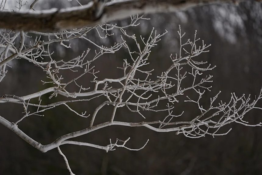
Is this the start of consistently cooler fall weather, or will warmer stretches return before winter sets in?
How cold did Wisconsin get?
Much of the state saw temperatures dip just below freezing in the low 30s, while the National Weather Service office in Green Bay warned of mid-20s readings in parts of north-central and northeast Wisconsin.
Will temperatures finally cool in Wisconsin for autumn?
Nighttime lows are expected to rebound into the upper 30s to low 40s by midweek, then rise into the upper-50s across much of the state by the weekend. Daytime temperatures will continue to reach the upper-60s to mid-70s.
Overall, Wisconsin is likely to experience a warmer-than-normal, milder fall, though the return of La Niña could make the winter outlook more uncertain.
How does La Niña influence Wisconsin winters?
La Niña tends to shift the jet stream northward. For the Great Lakes region, that historically means colder-than-average temperatures and above-average snowfall. It also increases the likelihood of polar air intrusions — when the polar vortex, a ring of strong winds that normally keeps Arctic air bottled up near the North Pole, weakens or wobbles, allowing frigid air to spill south into the United States, often bringing freezing temperatures and significant snowfall.
While Wisconsin generally receives less lake-effect snow than Michigan due to prevailing wind directions, La Niña winters often feature stronger westerly to northwesterly winds over the Great Lakes, which can fuel heavy lake-effect snow, according to the National Oceanic and Atmospheric Administration. This is especially common along the Lake Michigan and Lake Superior snowbelts, impacting largely Michigan and New York. If the lakes remain ice-free later into the season, as anticipated due to the warmer-than-normal temperatures, snow events can be more frequent and more intense.
During past La Niña years, parts of western and northern Michigan have seen multiple lake-effect snowstorms dropping several feet in short periods. Southern Wisconsin may not experience the same lake-effect totals, but it can still see colder-than-average temperatures and occasional heavy snow when Arctic outbreaks align with storm systems.
Similarly, in November 2022, Buffalo experienced a record-setting lake-effect snowstorm during a La Niña winter, when cold northwesterly winds over Lake Erie dumped several feet of snow in just a few days.
What is La Niña?
La Niña — Spanish for “the girl” — happens when the surface waters of the central and eastern Pacific Ocean are colder than normal for several months in a row, according to the National Weather Service. It’s part of a natural climate pattern called the El Niño–Southern Oscillation, which flips back and forth every few years between La Niña (cooler waters) and El Niño (warmer waters).
These shifts in ocean temperatures may seem small, but they can nudge the jet stream and change weather patterns all over the world. While its counter part El Niño — “the boy” — often brings milder winters to the northern U.S., La Niña tends to set the stage for colder snaps and more volatile conditions there.
When ocean temperatures in the central and eastern Pacific are close to average — not unusually warm like El Niño or unusually cool like La Niña — scientists call it ENSO neutral. Neutral conditions mean the Pacific isn’t giving the atmosphere a strong push one way or the other, so seasonal weather patterns are more likely to be shaped by other factors, like the Arctic or Atlantic oceans.
What is lake-effect snow?
Lake-effect snow occurs when cold, dry Arctic air moves over a large, relatively warm lake, creating narrow bands of clouds. This phenomenon can produce snowfall that lasts anywhere from a few minutes to several days.
Wind direction is also crucial in determining which areas will receive lake-effect snow. Heavy snowfall may occur in one location while the sun shines just a mile or two away in either direction.
When is the average first snow in Wisconsin?
The National Weather Service issued multiple frost and freeze warnings and advisories across Wisconsin this week. Here’s when frost and freezing temperatures typically occur in the state, based on historical data.
Here’s the average first snow for each region, though it may come later this year, as temperatures are expected to be above normal.
Northern Wisconsin (e.g., Ashland, Rhinelander)
-
First measurable snow: mid-to-late October
-
First 1-inch snow: late October
Central Wisconsin (e.g., Wausau, Stevens Point)
-
First measurable snow: late October to early November
-
First 1-inch snow: early November
Eastern Wisconsin (e.g., Green Bay, Milwaukee)
-
First measurable snow: Nov. 6–10
-
First 1-inch snow: mid-November
Western Wisconsin (e.g., Eau Claire, La Crosse)
-
First measurable snow: early to mid-November
-
First 1-inch snow: mid-November
Southern Wisconsin (e.g., Madison, Janesville, Racine)
-
First measurable snow: mid-November
-
First 1-inch snow: late November
Wisconsin weather watches and warnings
Stay informed. Get weather alerts via text
Brandi D. Addison covers weather across the United States as the Weather Connect Reporter for the USA TODAY Network. She can be reached at baddison@gannett.com.
This article originally appeared on Milwaukee Journal Sentinel: When will the unseasonably warm weather finally end in Wisconsin?