A California Geological Survey map released earlier this year depicts just how intense and damaging the shaking from future earthquakes will be across the state, revealing where the threat is most critical — and reminding that people can prepare.
Using calculations from a U.S. Geological Survey model, the potential shaking depicted in the map released in July is not from one future earthquake, but “what an area could experience over the course of time.” The earthquake shaking potential is represented by the Modified Mercalli Intensity Scale, which measures the intensity or the effects experienced of an earthquake, according to USGS.
A graphic of the full Modified Mercalli Intensity Scale, which can be used to better understand the impact an earthquake has on an area.
“Every earthquake has one magnitude (the amount of energy released by the earthquake) but can generate many different intensities of earthquakes shaking,” said Wendy Bohon, branch chief at the California Geological Survey, in an email to the Desert Sun.
Californians have experienced several sizable tremors this year, from a 5.2-magnitude earthquake near Julian in April to the more recent 4.3-magnitude earthquake in the San Francisco Bay Area on Monday, Sept. 22. In between was a tsunami threatening the West Coast triggered by an earthquake off Russia’s Kamchatka Peninsula.
Hazard maps related to earthquake intensity are available to people via the California Department of Conservation’s website, where users can interactively explore the level of threat the area they live in faces or make comparisons.
Among what Californians should keep in mind when using these maps, said Bohon, is preparedness.
“Effective” efforts to plan and prepare can “significantly reduce earthquake losses” and speed up recovery, Bohon said.
“There is no such thing as a natural disaster, just natural hazards like earthquakes that can impact vulnerable communities and infrastructure,” Bohon said. “We can’t stop natural hazards, but we can make our communities and infrastructure less vulnerable, reducing the possibility of a disaster.”
Damaging earthquake shaking ‘possible anywhere’ in California

A map depicting the earthquake shaking potential for California. Regions shaded in deeper reds and oranges face more damaging impacts than regions in pale yellow.
Bohon said of the earthquake shaking potential map that while the highest hazard areas are near major, active faults, strong and damaging earthquake shaking is “possible anywhere in California.”
Still, “most Californians live within 30 miles of an active fault,” according to Bohon.
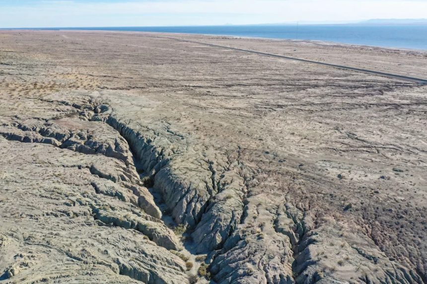
Certainly, the San Andreas Fault, stretching from the Salton Sea to the San Francisco Bay Area, shows that the area along it is forecasted to experience some of the most intense shaking, the kind associated with structural damage to landslides, according to MMI scale.
More eastern reaches of the Central Valley, largely south of Roseville and extending past Visalia, are generally predicted to see strong to very strong shaking on the MMI scale, associated with heavy furniture being moved to some building damage. The Bay Area and Los Angeles are two major regions facing some of the more critical threats. Less populous but facing no less of a severe threat, El Centro is in Imperial County.
“Local geologic conditions can have a significant influence on the intensity of earthquake shaking,” Bohon said. “Generally, soft sands and soils will shake harder and for a longer period of time, almost like shaking a bowl of Jello, and you can see this reflected in the patterns of shaking potential on the map.”
Paris Barraza is a trending reporter covering California news at The Desert Sun. Reach her at pbarraza@gannett.com.
This article originally appeared on Palm Springs Desert Sun: California map shows where, how intense earthquake shaking could be