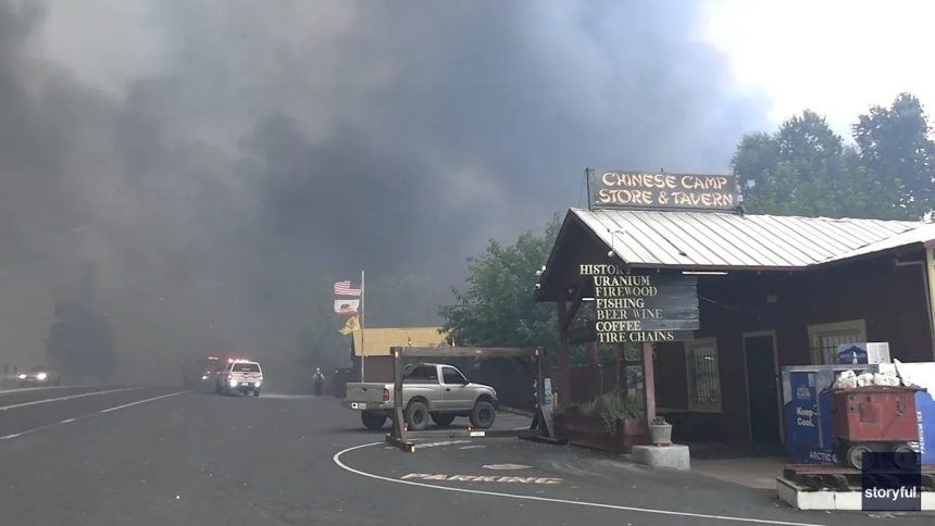
Multiple wildfires continue to burn across California, with several still at zero containment and threatening communities. Many of these fires ignited on Sept. 2, sparked by dry lightning during monsoon season.
High temperatures, dry winds, and low humidity have fueled fire activity since August, and while peak wildfire season usually occurs in August, the risk this year could extend into fall as above-normal temperatures are expected to linger across the state.
Smoke from the fires has caused air quality to plummet in some areas, reaching “hazardous” levels on the Air Quality Index (AQI).
Here’s the latest on California’s wildfire activity and air quality.
Crews race to shield McKinley Grove as Garnet Fire surges
Firefighters in California’s Sierra National Forest are mounting an aggressive defense to protect the ancient giant sequoias of McKinley Grove as the Garnet Fire continues its explosive growth. Now burning more than 53,000 acres, the blaze has become the third-largest wildfire in the state this year, fueled by dry conditions and dense vegetation in the Sierra Nevada foothills
Crews have carved shaded fuel breaks along McKinley Grove Road, using controlled fire to clear excess vegetation and create defensible space. According to the U.S. Forest Service, these breaks are part of a broader strategy to suppress the fire’s southern edge and prevent it from crossing into the grove itself.
The area is home to some of the oldest and tallest trees in the region, and officials have made their protection a top priority.
California wildfire map
Air quality map in California
Major active wildfires in California
Gifford Fire
-
Where: San Luis Obispo, Santa Barbara Counties
Garnet Fire
Salt 14-2 Fire
TCU September Lightning Complex
-
Where: Calaveras, Stanislaus, San Joaquin, Tuolumne
Dillon Fire
6-5 Fire
Blue Fire
Log Fire
6-2 Fire
What is a red flag warning?
A Fire Weather Watch or Red Flag Warning is issued when the combination of dry fuels and weather conditions supports extreme fire danger, according to the National Weather Service. Each NWS office creates local criteria for fire weather watches and red flag warnings.
What should you do during a red flag warning and wildfire prevention tips
Forecasters warn residents under a red flag to take extra precautions to prevent wildfires. Follow these steps to reduce the risk of fire on your property and in your community:
Monitor local alerts
-
Stay updated with your local wildfire offices, fire departments and emergency management.
-
Check air quality forecasts—smoke from nearby wildfires can reduce visibility and cause health issues.
Prepare your home and property
-
Water lawns, shrubs, and trees if possible.
-
Clear dry brush, leave,s and other flammable material from around your home.
-
Move flammable items (firewood, propane tanks, grills) away from buildings.
Have an emergency kit ready
-
Include water, non-perishable food, medications, masks (for smoke), flashlights, batteries, important documents, and a first-aid kit.
-
Keep vehicles fueled and ready in case of evacuation.
Avoid activities that could start a fire
-
Do not burn trash, brush, or use open flames.
-
Use grills or smokers only on gravel or paved surfaces.
-
Avoid driving over dry grass or brush.
-
Ensure chains or metal parts on vehicles aren’t dragging to prevent sparks.
-
Be cautious with cigarettes, matches and glass bottles outdoors.
Fire safety if burning is allowed
-
Cover burn barrels with a weighted metal lid (holes no larger than ¾ inch).
-
Keep a 10-foot radius clear of flammable material around any fire.
-
Extinguish fires completely with water; stir to make sure everything is cold.
-
Never leave fires unattended.
Electrical safety
-
Report downed utility poles immediately to local officials or your electricity provider.
-
Do not approach any potentially energized lines.
Health precautions
-
If air quality drops, stay indoors as much as possible.
-
Use masks or respirators if you need to go outside.
California weather watches and warnings
Stay informed. Get weather alerts via text
Brandi D. Addison covers weather across the United States as the Weather Connect Reporter for the USA TODAY Network. She can be reached at baddison@gannett.com.
This article originally appeared on Palm Springs Desert Sun: Wildfire smoke maps show size, containment and air quality in California