Hurricane Charley rapidly intensified and made landfall in southwest Florida as a Category 4 on this date 21 years ago, then tore across the state’s peninsula like a buzzsaw, producing extreme wind damage along the way.
Charley roared ashore near Cayo Costa, Florida, or west of Fort Myers, packing maximum sustained winds of 150 mph on the afternoon of Aug. 13, 2004. The intensification of Charley prior to landfall was a worst-case scenario since nearly eight hours earlier over the eastern Gulf, it was a Category 2 with 110 mph winds.
The fierce hurricane was small in size, but left behind a trail of wind damage resembling a very large tornado from Punta Gorda and Port Charlotte in southwest Florida to Orlando and Daytona Beach as it raced across the Florida Peninsula in just seven hours.
Orlando, about 125 miles from where Charley first made landfall, measured sustained hurricane-force winds (79 mph) with a peak gust of 105 mph.
Charley’s small size prevented storm surge from being as high as you would typically associate with a Category 4. Visual evidence at Sanibel Island suggested a peak storm surge of 6 to 7 feet above ground.
Charley caused an estimated $26.7 billion in damage (adjusted to today’s dollars) and was blamed for 35 deaths, according to NOAA.
For Florida, Charley would be just the first of four hurricanes to impact the state in about 45 days during the 2004 season. Charley was followed by Frances and Jeanne making landfall along the state’s Atlantic coast, and then Ivan’s strike on the western panhandle region.
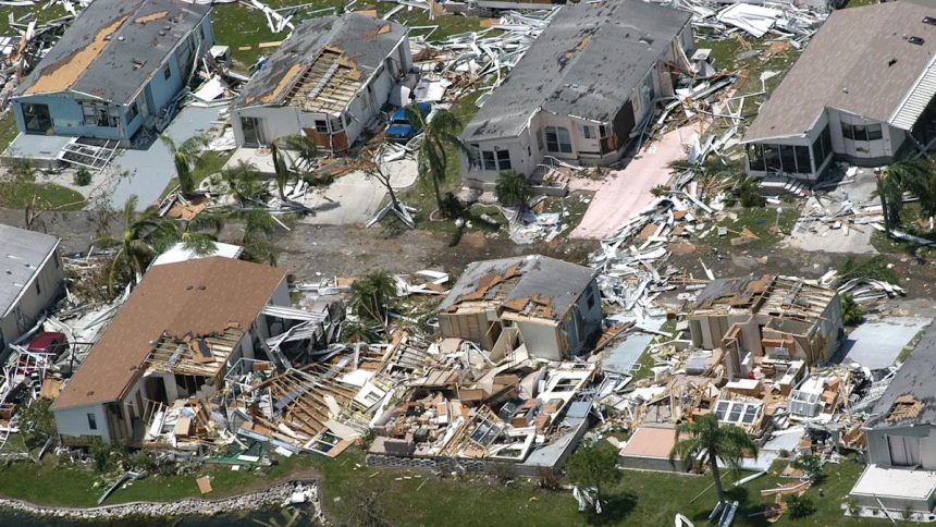
Wind damage caused by Hurricane Charley in Punta Gorda, Florida. (Photo by Tim Boyles/Getty Images)
Chris Dolce has been a senior digital meteorologist with weather.com for 15 years after beginning his career with The Weather Channel in the early 2000s.