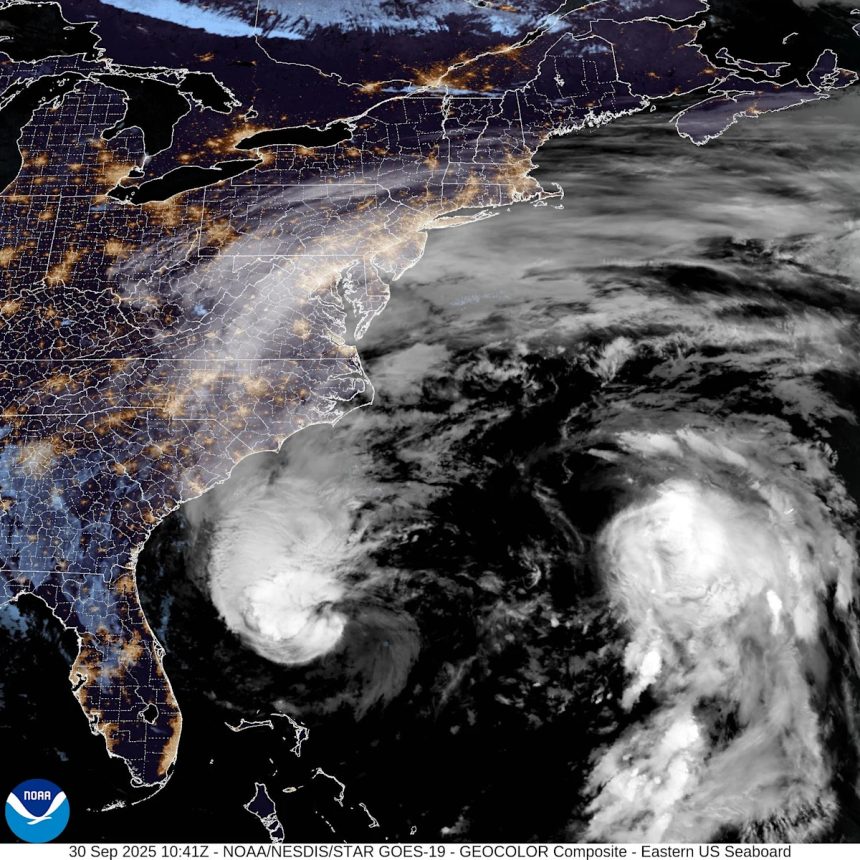
Tropical Storm Imelda became Hurricane Imelda Tuesday morning, Sept. 30, according to the National Hurricane Center.
Imelda is the fourth hurricane of the 2025 Atlantic hurricane season.
Imelda is slowly starting to away from Florida, according to the hurricane center’s latest advisory.
The storm is expected to strengthen over the next 48 hours as it turns to the northeast.
Dangerous beach conditions, including rough surf and life-threatening rip currents are expected on Florida’s east coast for the next several days.
➤ Weather alerts via text: Sign up to get updates about current storms and weather events by location
Additionally, coastal flooding of 1 to 2 feet is possible from the Volusia/Brevard line to the South Santee River in South Carolina, per the NHC.
Highlights on what Hurricane Imelda is doing now
Special note on the NHC cone: The forecast track shows the most likely path of the center of the storm. It does not illustrate the full width of the storm or its impacts, and the center of the storm is likely to travel outside the cone up to 33% of the time.
-
Location: 259 miles east of Daytona Beach; 755 miles west-southwest of Bermuda
-
Maximum sustained winds: 75 mph
-
Movement: northeast at 7 mph
Hurricane Imelda spaghetti models, path
Special note about spaghetti models: Illustrations include an array of forecast tools and models, and not all are created equal. The hurricane center uses only the top four or five highest performing models to help make its forecasts.
What to know about Hurricane Imelda

At 8 a.m., the center of Hurricane Imelda was located by an Air Force Hurricane Hunter aircraft near latitude 29.0 North, longitude 76.9 West.
Imelda is moving toward the northeast near 7 mph. This general motion is expected through today, followed by a turn toward the east-northeast at a faster forward speed by tonight.
On the forecast track, the center of the system should move away from the Bahamas today and quickly be approaching Bermuda late on Wednesday, Oct. 1.
Maximum sustained winds have increased to near 75 mph, with higher gusts.
Some additional strengthening is forecast during the next 48 hours.
Hurricane-force winds extend outward up to 70 miles from the center and tropical-storm-force winds extend outward up to 185 miles.
The estimated minimum central pressure is 980 mb.
Is there a hurricane coming toward Fort Myers, Cape Coral, Lee County, Florida?
No. While Imelda did strengthen into a hurricane Tuesday morning and is expected to continue strengthening over the next 48 hours, the storm is forecast to remain east of Florida and the U.S.
What impacts will Hurricane Imelda have on Florida?

Expected impacts to Florida and the southeastern U.S. from Tropical Storm Imelda as of Sept. 29, 2025.
The National Weather Service said residents along Florida’s east coast can expect:
-
Hazardous conditions along the coast, with breaking waves of 6-10 feet.
-
Life-threatening rip currents.
-
Poor to dangerous boating conditions, with seas of 9 to 18 feet possible.
-
Breezy conditions, with wind gusts up to 25 mph possible, especially along the coast.
-
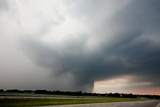
Scattered to numerous showers across east central Florida, with the potential for additional outer rain bands moving onshore.
Weather radar for Fort Myers, Cape Coral, Lee County, Florida

Current weather watches and warnings issued in Fort Myers, Cape Coral, Lee County, Florida
Excessive rainfall forecast across Fort Myers, Cape Coral, Lee County, Florida
Key messages from the National Hurricane Center: What you need to know about Hurricane Imelda
-
Imelda intensified into a hurricane Tuesday and is expected to approach Bermuda during the day Wednesday as a hurricane. Tropical storm conditions are expected to begin Wednesday afternoon.
-
Locally heavy rainfall across coastal sections of southeast North Carolina could cause isolated flash and urban flooding through tonight. As Imelda passes near Bermuda, 2 to 4 inches – 50 to 100 mm – of rainfall is expected from Wednesday into Thursday.
-
Swells and high surf from both Humberto and Imelda are expected to produce dangerous marine conditions and rip currents along much of the East Coast of the United States during the next several days.
Current forecast: Imelda strengthens into Category 1 hurricane
What impact could Hurricane Imelda have and what areas could be affected?
-
Wind: Hurricane conditions are possible within the watch area by Wednesday night, with tropical storm conditions possible by Wednesday afternoon.
-
Storm surge: Minor coastal flooding is possible in areas of onshore winds over the southeastern U.S. coastline. The water could reach the following heights above ground somewhere in the indicated areas if the surge occurs over the next several high tide cycles:
-
Volusia/Brevard County Line, Florida to the South Santee River, South Carolina — 1 to 2 ft
-
-
Rainfall: Storm total rainfall amounts of 1 to 2 inches with local maxima of 4 inches are expected through tonight across coastal sections of southeast North Carolina. This rainfall could result in isolated flash and urban flooding. As Imelda passes near Bermuda, 2 to 4 inches of rainfall is expected from Wednesday into Thursday.
-
Surf: Swells generated by Tropical Storm Imelda and Hurricane Humberto are affecting the Bahamas and are currently spreading to much of the U.S. east coast. These swells are likely to cause life-threatening surf and rip current conditions.
Forecasters urge all residents to keep an eye on the tropics and to always be prepared
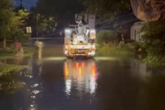
Officials regularly encourage Florida residents to prepare for storms before a hurricane is approaching, while shelves are fully stocked and you aren’t battling crowds all rushing to the store at the same time.
“It only takes one storm to make it an impactful year for your community,” the National Hurricane Center Miami posted on X.
➤ See list of emergency supplies you can now buy tax free
On Aug. 1, specific hurricane supplies became permanently tax-free in Florida, ranging from batteries to generators.
➤ Don’t have a hurricane supply kit? From the basics to the extras, here’s what you need
Here are some of the basics you should have:
-
Two-week supply of medications
-
A go-bag with essential supplies in case you need to leave quickly
-
Portable cellphone chargers
-
List of emergency phone numbers, including those for family members
-
Copy of your insurance policy
When does hurricane season end?
The Atlantic hurricane season runs from June 1 through Nov. 30.
Ninety-seven percent of tropical cyclone activity occurs during this time period, NOAA said.
The Atlantic basin includes the northern Atlantic Ocean, Caribbean Sea and the newly renamed Gulf of America, formerly the Gulf of Mexico.
Stay informed. Get weather alerts via text
Download The News-Press app to ensure you’re always connected to the news. And look for our special subscription offers here.
This article originally appeared on Fort Myers News-Press: NOAA hurricane center tracking Imelda. Fort Myers, FL impact?