A stretch of the Florida coast from Palm Beach County to Volusia County was placed under a tropical storm watch Saturday morning — though the strongest winds of soon-to-be Tropical Storm Imelda were expected to stay well offshore.
The long-term forecast for the system, which reached depression strength and was expected to become a tropical storm later tonight or Sunday, remained tricky.
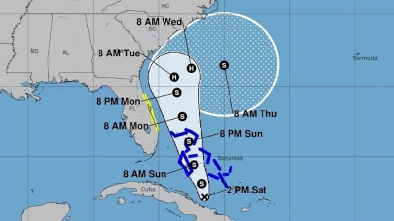
The predicted path for the next few days would keep Imelda’s core off Florida coast as it tracks north. But forecasters now believe it could avoid a direct landfall as it nears the Carolinas and instead be yanked out to sea, likely by the strong atmospheric pull of Category 4 Hurricane Humberto.
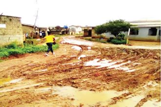
That would still mean heavy rain for the Carolinas, and the forecast that far out remains uncertain, meaning the path could shift back to favoring landfall or a stalled out storm just off the coast dumping rain on a state that suffered devastating flooding during Hurricane Helene last year.
It could also mean tropical storm gusts and pounding surf for much of the east central Florida coast — the reason why the National Hurricane Center put the area from Palm Beach to Volusia under a tropical storm watch. That means worsening conditions could be felt in the next 48 hours.
The “most likely scenario” is that surf and sea conditions begin to go downhill in South Florida starting Sunday, making the coast less safe for boaters and swimmers for a few days, according to the National Weather Service’s Miami office.
A “less likely scenario,” the weather service said, is that outer fringes of the system may blow bands of rain and gusty wind across South Florida early next week as the system passes by.
The National Weather Service’s Tampa Bay office said in a post on X Saturday morning that “no significant impacts” are expected across west-central and southwest Florida.
As of 2 p.m. Saturday, the system was a tropical depression located about 195 miles northwest of the eastern tip of Cuba, according to the National Hurricane Center.
It was expected to strengthen into Tropical Storm Imelda later Saturday night, right before it crosses the Bahamas, much of which remains under a tropical storm warning.
The system is on track to pass Florida from Sunday evening through Tuesday morning, when it could strengthen into a Category 1 hurricane.
From there, the storm is expected to slow down and spend the next two to three days near the Georgia and South Carolina coast, although it is now no longer expected to come ashore.
“It should be noted that while this forecast keeps the system offshore, it would still be large enough and close enough to cause wind and coastal flooding impacts along the southeastern U.S. coast, as well as heavy rainfall/flooding concerns in inland areas,” forecasters wrote early Saturday.
Long-range storm models are in pretty good agreement about the system’s path through at least Tuesday, the hurricane center said. From there, they diverge. A few take the storm inland over the Carolinas, others stall it out near the coast and still others drag it out to sea to get closer to the powerful Hurricane Humberto.
As of Saturday morning, Humberto was a Category 4 hurricane after undergoing extreme rapid intensification. It’s the third hurricane this season and the third to become a major hurricane.
John Morales, hurricane specialist at NBC6, noted on X that it was the first time since 1935 that the first three hurricanes in a season were all major hurricanes.
The latest hurricane center forecast calls for Humberto to approach the edge of Category 5 as soon as Sunday, potentially sending a ripple effect of high waves and rough surf to islands hundreds of miles away from the strong storm.
Times staff writer Emily Wunderlich contributed to this report.
• • •
Tampa Bay Times hurricane coverage 2025
Here’s a look at the 2025 hurricane season forecasts so far.
What to know about river flooding in Tampa Bay this hurricane season.
Here are the lessons you learned from Tampa Bay’s historic 2024 hurricane season.