BATON ROUGE, La. (Louisiana First) — The 2025 Atlantic hurricane season has been active in the tropics, but so far, the continental United States has largely been spared from major impacts.
While several storms have formed and tracked across the Atlantic basin, most have either stayed out to sea or weakened before reaching land. With the peak of the season still underway, however, forecasters caution that the risk to the U.S. is far from over.
So far this season, we have had eight named storms, soon to be nine if and when Tropical Depression Nine is named Imelda. Three of these storms have reached hurricane status, and all three have also reached major hurricane status.
Early season activity:
Tropical Storm Andrea was the first storm to be named this season. Getting its tropical storm status on June 23, Andrea marked the latest start to the tropical season since 2014. TS Andrea stayed out to sea and was named our first fish storm of the season: a good predictor of what was to come.
Next came TS Barry, which developed along the Bay of Campeche in the Gulf and moved inland over northern Mexico and south Texas. The moisture remnants from Barry caused catastrophic flooding in Texas’ Hill Country during the July 4 weekend.
Search and rescue teams comb the banks of the Guadalupe River after a flash flood swept through the area, Saturday, July 12, 2025, in Kerrville, Texas. (AP Photo/Eric Gay)
On that same day, Tropical Storm Chantal formed off the east coast of Florida and tracked northward, making a South Carolina landfall. Some places in the state accumulated 10 inches of rain and measured wind gusts as high as 55 mph.
Why was this part of the season so dull compared to what was forecasted?
If you didn’t know, hurricanes develop from areas of low pressure over tropical waters. The low pressure causes instability in the atmosphere around it, which causes thunderstorms to develop. With these thunderstorms over very warm, tropical waters, they have extra fuel to strengthen into storms and eventually tropical storms. During July, a strong high-pressure system known as the Azores High was over the Atlantic Ocean, which helped in decreasing most thunderstorm activity. This is why, for almost an entire month, we didn’t see any kind of formation whatsoever.

The effects of the Azores High on tropical systems.
Mid-Season activity:
By early August, we got our next few named storms: Dexter, Erin, and Ferdinand. Tropical Storm Dexter developed off the coast of North Carolina and then moved out to sea, not causing anything. Hurricane Erin, on the other hand, caused rip currents along the entirety of the East Coast.
For multiple days, meteorologists warned those in the Outer Banks of NC and those in Bermuda to beware of this storm as it had briefly reached category 5 status during its time north of Anguilla. The good news is that Erin weakened to a category 2 by the time it squeezed by between the East Coast and Bermuda, both of which avoided any direct impacts. As Erin became “extratropical”, meaning it still held its low pressure, but no longer gained energy from the warm, tropical waters, Tropical Storm Ferdinand formed just southeast of Bermuda, becoming yet another fish storm.
We then didn’t see any tropical activity for the first half of September. This is unusual because peak hurricane season is in September, meaning statistically, most of our storms happen during this time frame. Well, lots of Atlantic wind shear and Saharan Dust inhibited any type of development during this time.
Unfortunately, just days after the peak of the season, Hurricane Gabrielle formed east of the Leeward Islands. However, at this time, the Azores High was well off to the east of the Atlantic Ocean, which helped steer Gabrielle northward before it could track west towards the U.S. Gabrielle made its sharp right turn just after missing Bermuda by about 200 miles as a Category 4.
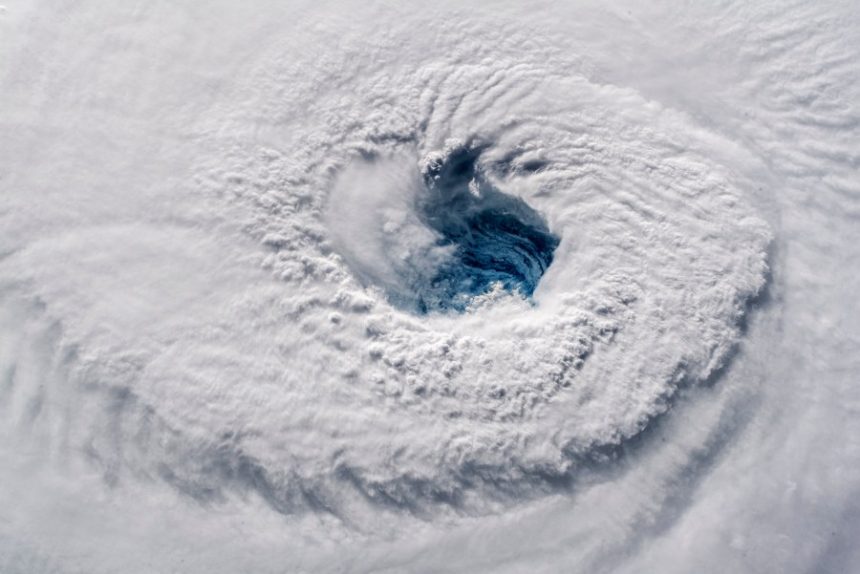
Then came Hurricane Humberto. We are still monitoring Humberto, but the forecasts bring Humberto between the East Coast and Bermuda, just like Hurricane Erin earlier this season. Humberto briefly reached category 5 status, but has since undergone an Eyewall Replacement Cycle and weakened to a category 4. With Tropical Depression Nine now on the horizon of becoming Imelda, all eyes in the U.S are focused on the East Coast and the impacts this storm could have.
The good news is that with Humberto being around 600 miles from TD 9, Humberto will likely pull TD9 away from the East Coast. This is not to say that TD 9 won’t cause any impacts to the East Coast, but it is looking increasingly likely that the Carolinas will be spared from any major impacts.

Satellite imagery of Hurricane Humberto (right) and Tropical Depression 9 (left) – September 27, 2025, GOES-East
So, what about the Gulf? Why haven’t we seen much activity?
Well, there are multiple reasons as to why we’ve had low activity. The Gulf has seen an unseasonably high amount of wind shear, which tropical systems don’t like. Wind shear practically topples systems over to where they can’t maintain their vertical structure. We’ve also had a pretty persistent heat dome over much of North America for the last few months. This heat dome has limited the number of cold fronts that have come off the southeast and into the Gulf. Most cold fronts cause many storms before they roll through an area, and such is true when the front leaves land and travels into the Gulf. These cold fronts over the Gulf can help initiate storm activity and provide extra moisture. Cold fronts are also attached to a big low-pressure system, so they have some spin to them, which can cause those storms they initiate over the Gulf to spin. With the lack of these cold fronts from the heat dome we’ve been experiencing, especially here in Louisiana, storm activity in the Gulf has been pretty minimal.
This isn’t to say we aren’t going to have any storms form in the Gulf this season, we still have two more months to go. But it is interesting to see how and why storms form and track the way they do. The Gulf is still very warm, and there haven’t been any storms to tap into that warmth yet, so if you live in Louisiana, especially along the coast, don’t lower your guard just yet. We still have the rest of hurricane season to go.

Timeline of the 2025 hurricane season so far, with storm names and strength.
Latest News
Copyright 2025 Nexstar Media, Inc. All rights reserved. This material may not be published, broadcast, rewritten, or redistributed.
For the latest news, weather, sports, and streaming video, head to Louisiana First News.