PORTLAND, Ore. (KOIN) — As Portland and the Willamette Valley continue to see scattered rain showers, the higher elevations around the Pacific Northwest are bracing for significant snowfall.
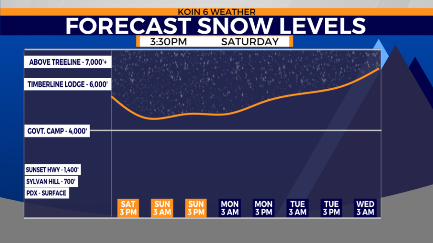
To help everyone prepare who is traveling or camping up in the mountains this weekend, the National Weather Service has issued a Winter Weather Advisory for the southern Washington Cascades down through both the northern Oregon Cascades and central Oregon Cascades above 4,000 feet.
This weather alert goes into effect at 8 a.m. Sunday and lasts until 11 a.m. Monday. These higher elevations should expect at least 2-6 inches of accumulated snow through Monday morning.
Above 5,000 feet the snowfall could total closer to a foot by the time we get to Monday afternoon.
As for the impact on the roadways, drivers should be prepared for slick conditions on bridges and overpasses above 4,000 feet. But this winter weather will more likely impact the higher mountain passes, including White Pass and Santiam Pass.

If you or someone you know is traveling across mountain passes this weekend, give them a heads up about the forecast and always use caution while driving in these changing weather conditions. Also, be sure to bring a winter emergency driving kit with you that includes a blanket, a flashlight, a shovel and water.
Stay with the KOIN 6 Weather Team for the latest on the forecast across the Pacific Northwest.
Copyright 2025 Nexstar Media, Inc. All rights reserved. This material may not be published, broadcast, rewritten, or redistributed.
For the latest news, weather, sports, and streaming video, head to KOIN.com.